The main map for this project – this map has regular updates as more information is found.
Click the map to see it full size – use your browser’s “back button” to rejoin the main site.
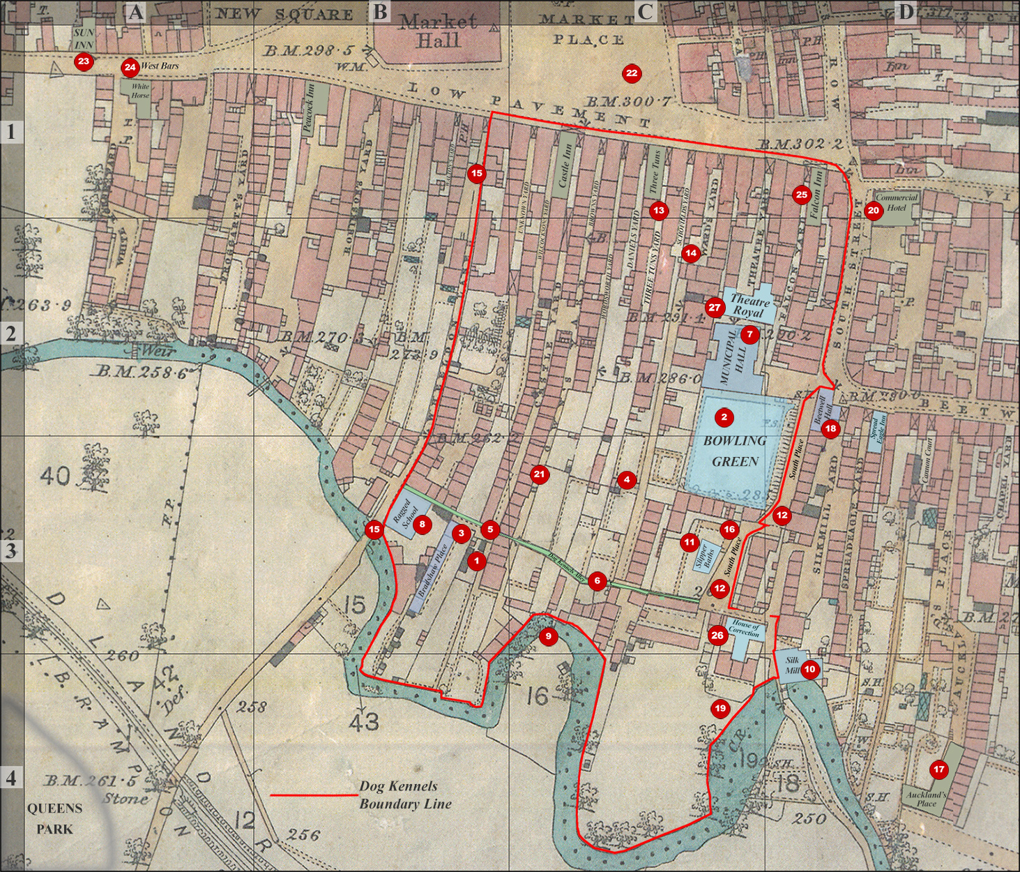
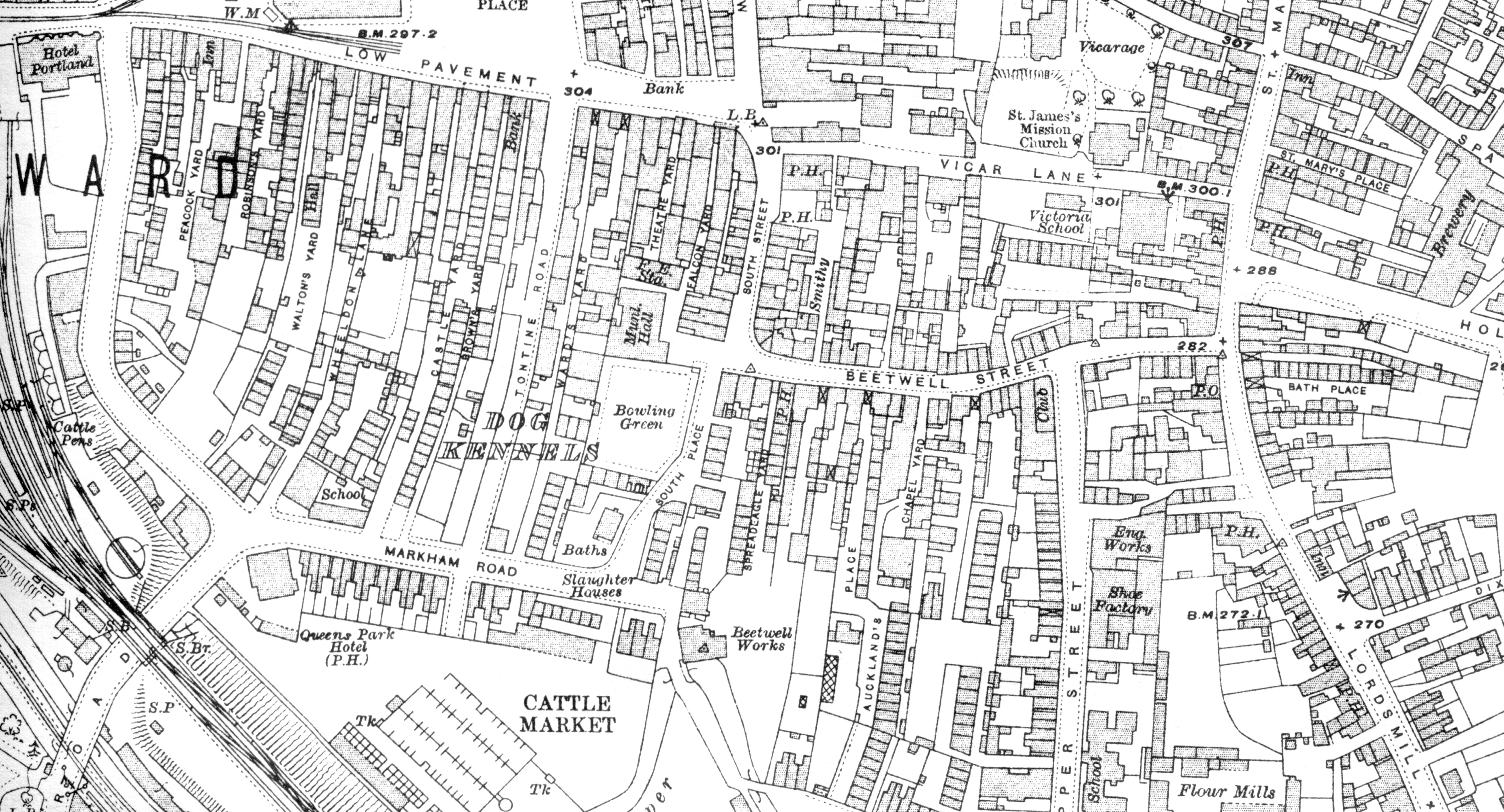
The Dog Kennels area is marked by the red line – buildings and other places of interest marked in pale blue and pale green.
Please note:
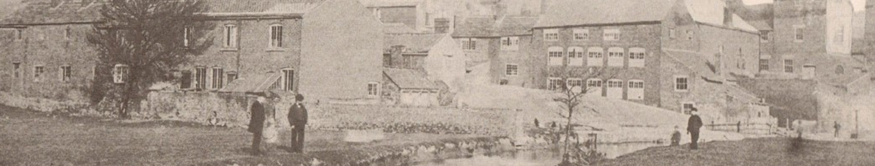
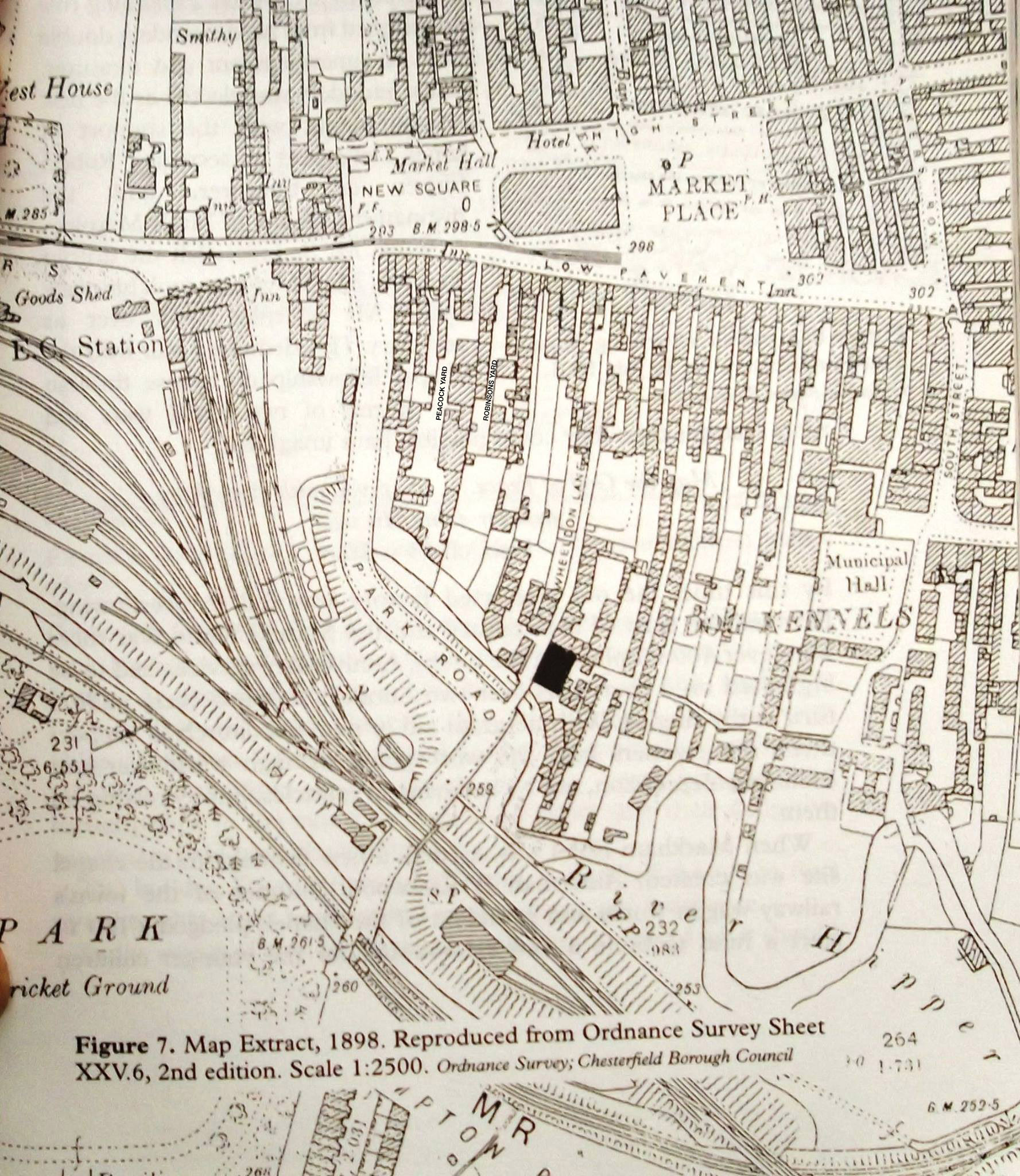
There are many photographs made at different times during the last 30 years of the Dog Kennels which we have added to this site. For example the Slipper Baths were not built until 1904 and Beetwell Hall was demolished in the mid 1880s but we have included both as they were important buildings. Therefore, there is no date for our map as it covers 30 years of photographs and associated information.
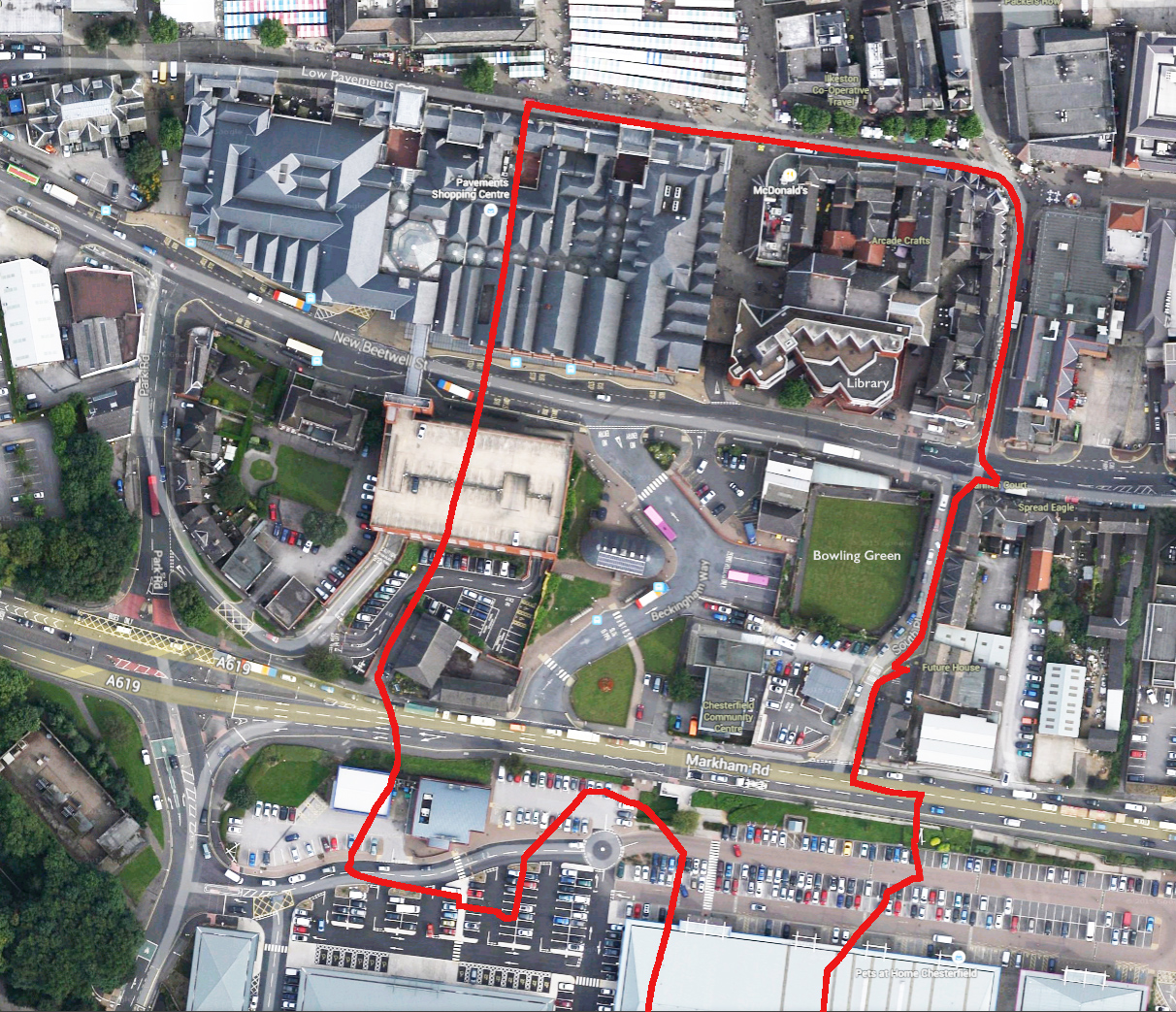
Guide as to where the Dog Kennel boundaries are these days.
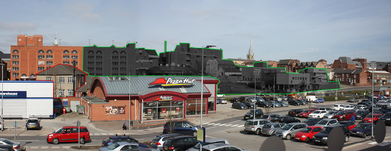
This photo is taken from Debenhams coffee shop on Ravenside Retail Park. This shows, albeit not very well, where the Dog Kennels were situated – all the buildings shaded dark grey have been built on what was the Dog Kennels. The Ragged School is the only surviving building, that can be seen in this shot, that survives today. It is outlined in red on the left of the photo
Brilliant website!
Marvellous to see the maps and the info on the yards etc. I now live in Melbourne, Australia and only now am getting interested in the history of Chesterfield, my home town. Many thanks for this web site.
Don Rawding
Really interesting, well-researched site Pete.
Thanks Nip – glad you like it.