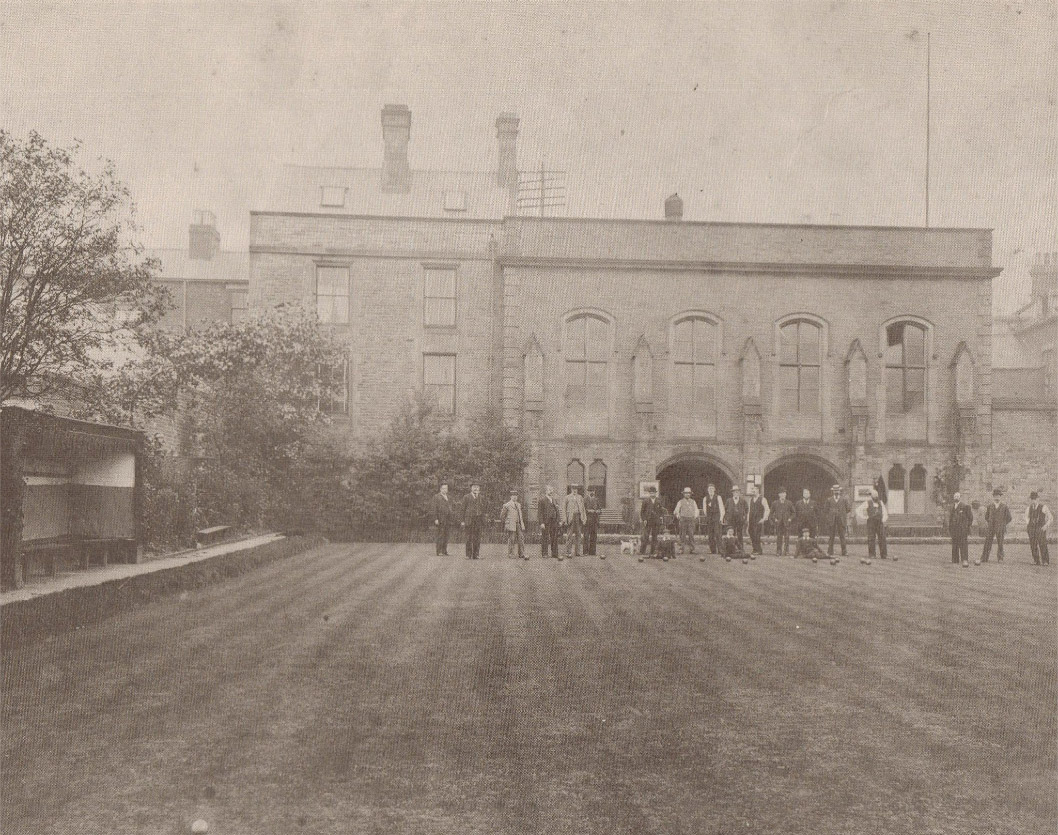
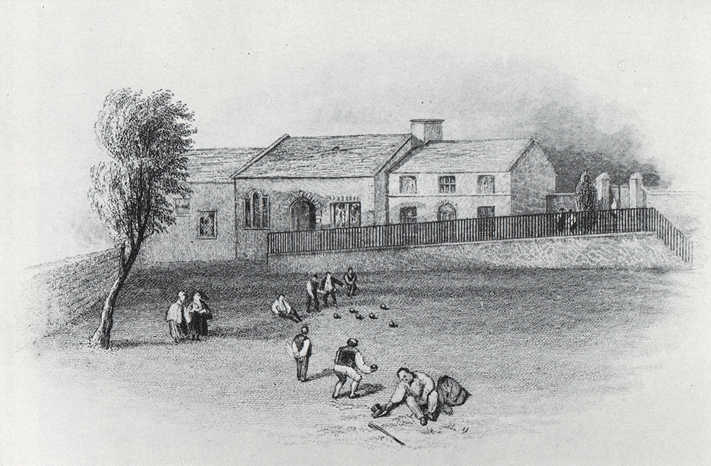
Reputed to be one of the oldest Bowling Greens in the country, Chesterfield Bowling Green is first mentioned in the 1600s although some date this back to the 1200s. It is situated on the western corner of New Beetwell Street and South Place on the opposite corner to Yeomans.
Below is footage of the Bowling Green in 1933.
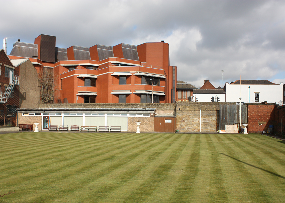
Below is how the Bowling Green looks today. The Municipal Hall has gone and the clubhouse can be seen on the far side of the green. The new library now dominates the view.
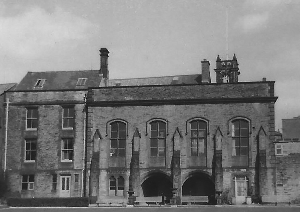
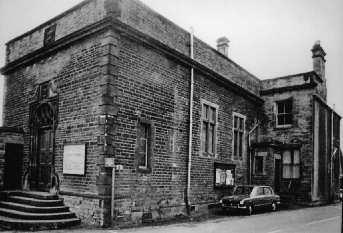
Chesterfield’s Municipal Hall was built in 1847 on the site of the Old Hall. It was built 12 years after the passing of the Municipal Reform Act of 1835 and was used as a Council Chamber and Police Court. The building closed in 1965 and is now demolished. – See more at: http://jiscmediahub.ac.uk/record/display/061-oaiwwwculturegridorgukPictureThePast2249916;jsessionid=1EED77F18AE387BCD53E691AA67FB4E9?mhevent=related?mhevent=related#sthash.2TlyfVPN.dpuf
Chesterfield’s Municipal Hall was built in 1847 on the site of the Old Hall. It was built 12 years after the passing of the Municipal Reform Act of 1835 and was used as a Council Chamber and Police Court. The building closed in 1965 and is now demolished. – See more at: http://jiscmediahub.ac.uk/record/display/061-oaiwwwculturegridorgukPictureThePast2249916;jsessionid=1EED77F18AE387BCD53E691AA67FB4E9?mhevent=related?mhevent=related#sthash.2TlyfVPN.dpuf
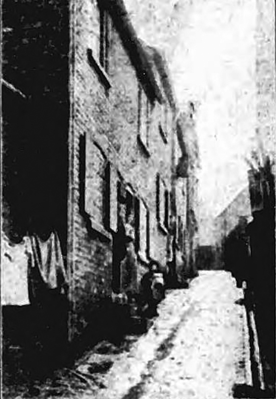
Wheeldon Lane was a main throughfare in the days of the Dog Kennels – and it also marked the western boundary. It ran south from Low Pavement down to the Ragged School and thence over the River Hipper towards Boythorpe.
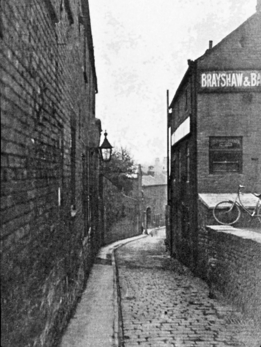
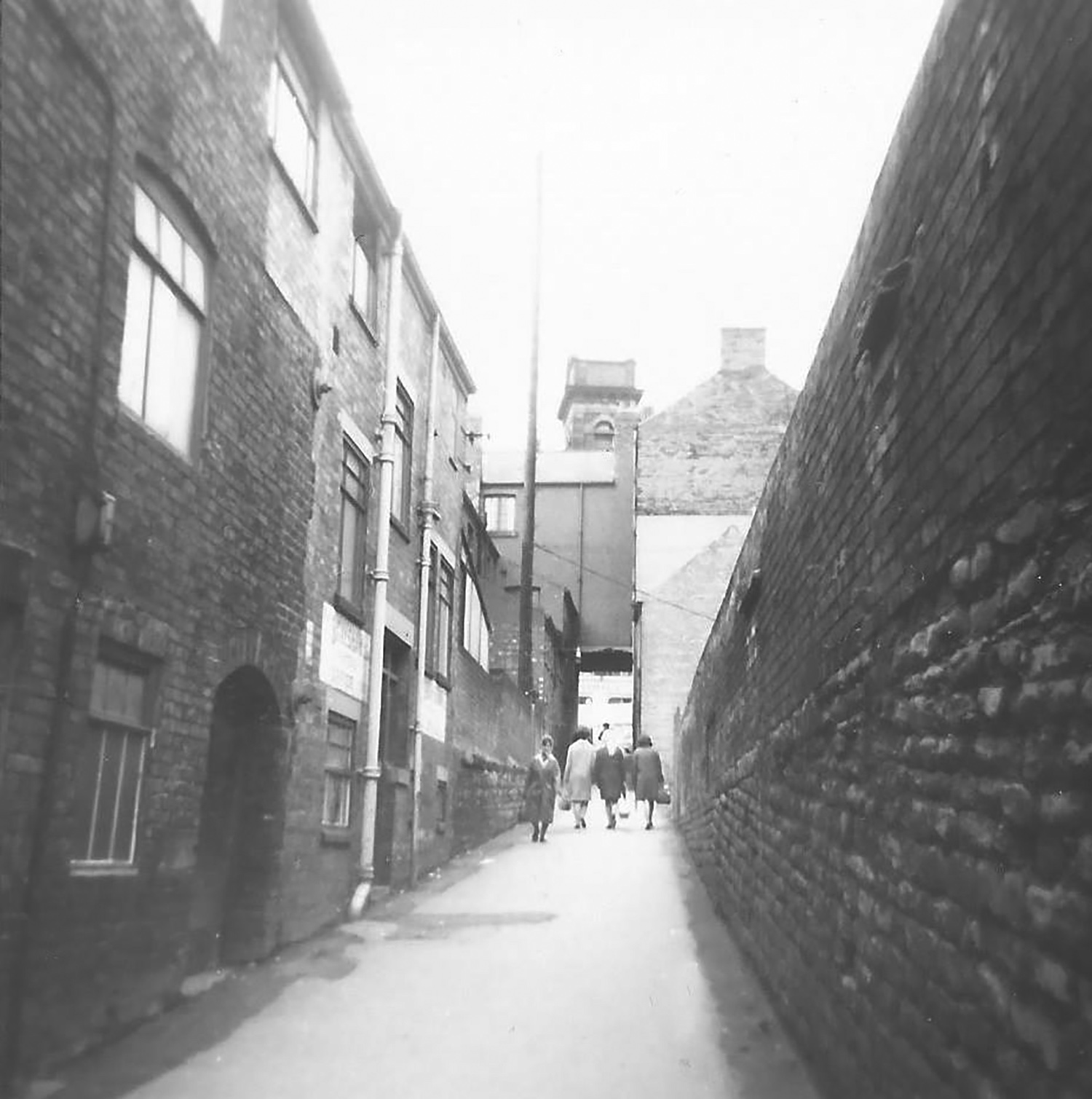
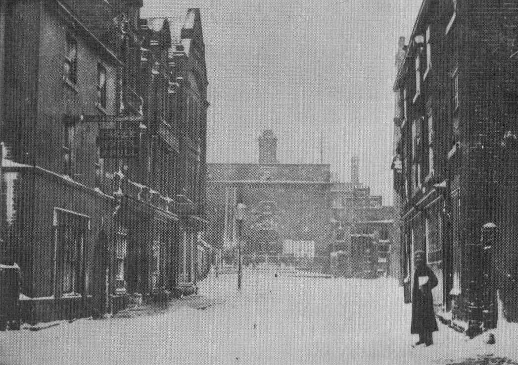
Wheeldon Lane photo taken looking down from the Market Hall end. Brayshaws was a printers after Masons Tobacco factory was moved to Spital.
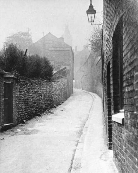
Wheeldon Lane looking towards Market Hall – you can see the archway where the lane opened out into Low Pavement opposite the Market Hall right in the middle of the picture.
What’s in a lane?
By Lesley Phillips
In the 1860s, the newspaper reports from Chesterfield Police Court regularly featured the occupants of Wheeldon Lane. This ancient Chesterfield Street gained such a bad name that in 1874 a deputation of local tradesmen and property owners went to a Town Council Meeting and demanded something be done about this nuisance.
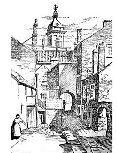
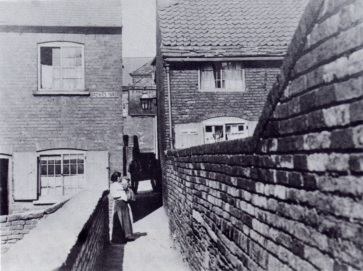
The arched entrance to Wheeldon Lane opposite the Market Hall
Wheeldon Lane is thought to have been named after a prominent 16th century Chesterfield family, and was possibly earlier known as ‘Steppestone Lane’ as it led down from the town to a crossing over the river Hipper.(W.E. Godfrey. Soutergate, a lost Chesterfield street. 1936).
By 1803 Potter’s Plan of Chesterfield (Chesterfield Library) shows a carpet factory with a steam engine on the lane, and trade directories of the period record Samuel Brown as a carpet manufacturer of Chesterfield. (Holden’s directories 1805 and 1809).
The site of the factory is now occupied by the exit barriers of the Pavements multi-storey car park.
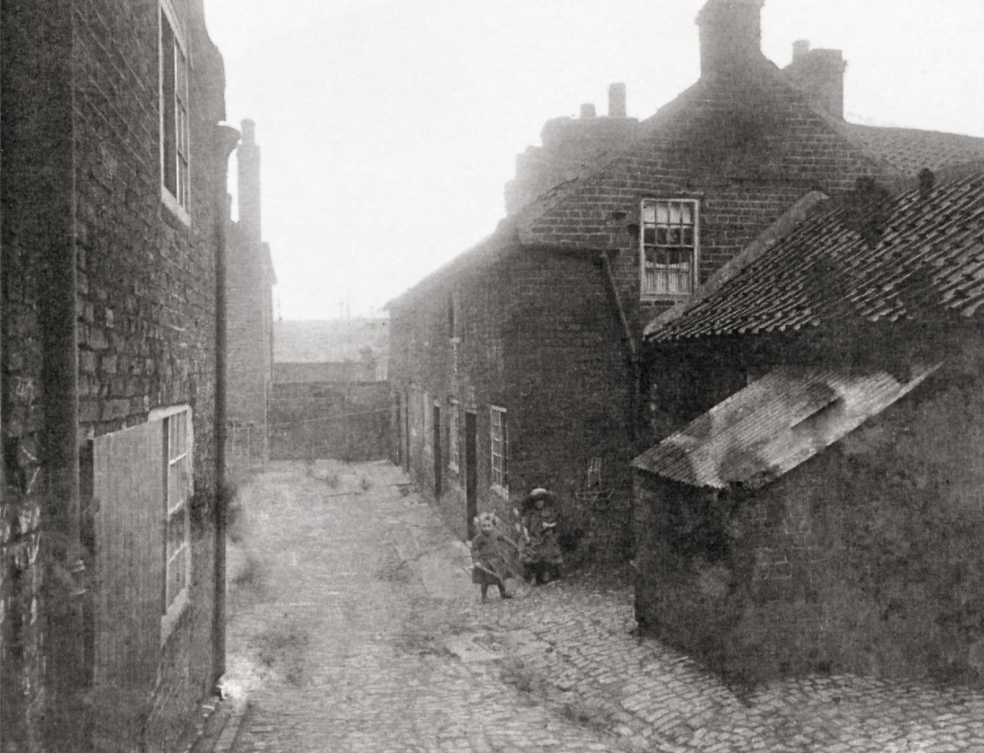
Maps show two courtyards on Wheeldon Lane; one near the top with a large house on the east side and poorer housing on the west side, and another court at the bottom of the lane near the river. The narrow public footpath running east from the north-east corner of this bottom court was called the Dog Kennels, as was the area it served. In his history of the Ragged School, D. Botham noted, ”Dog Kennels was the name on the blue enamelled sign that still rusted on the wall sixty years after the alley closed…” (D.F. Botham. A brief history of the Ragged School. 1998).
By 1836 the Burgesses of the Borough of Chesterfield were using their “new borough court in Wheeldon Lane” (Derby Mercury 12 Oct 1836); this building stood in the east side of the courtyard at the top of the lane near Low Pavement, on land owned by William Waller in 1849. Waller also owned the large house and garden to the south of this property. (Chesterfield tithe map and award 1849).
In 1849 Wheeldon Lane had two boot and shoemakers, a cooper and a lace factory. John Walker Waterhouse previously had the lace factory on Wheeldon Lane, and made national news in 1846 when he perfected a machine-made lace, which closely resembled fine Mechlin lace. By 1849 the lace factory was owned by John Thackeray & Son, and John Thackeray also owned the other industrial building to the south by the river, namely the iron foundry worked by John Wordsworth. Wordsworth’s mother was Ann Mason, and his cousin was George Mason who owned property in Wheeldon Lane, and who had a tobacco warehouse at the southern end of the top courtyard.
Across the river at the bottom of the lane was the Wheeldon Lane cricket ground used by the Chesterfield Cricket Club. (Derby Mercury 4 Jun 1823).
By 1851 Wheeldon Lane was home to 15 households consisting of a total of 56 people, whose trades included labouring, shoemaking, ironstone mining, pill box making and cotton spinning. One household included a schoolmaster. The neighbourhood was however falling into a decline, and in April 1852 two women were convicted of robbing a milkman in Wheeldon Lane as he returned home from his round. (Sheffield Independent 10 Apr 1852).
Brampton man John Silcock’s arrival in Wheeldon Lane in the mid-1850s heralded more problems. In 1858 he was described as a shoe maker (Derby Mercury 27 Oct 1858); by 1861 he had a beerhouse with a concert hall, and lodging house called the ‘Jolly Waggoner’. His concert hall was known as the ‘Princess Concert Room’, and the premises were all in the former lace factory (John Hirst. Chesterfield pubs. 2005).
On the night of the 1861 census there were 64 lodgers at the Jolly Waggoner. Another lodging house in Wheeldon Lane had 6 lodgers and Wheeldon Lane had suddenly become very densely populated. There were now 40 households, more than double the number on the previous census, and these were occupied by 247 people, 68 of whom were born in Ireland. Men outnumbered women by 3:2. The census shows a wide variety of occupations, including 4 sailors from Portsmouth, but labourers and colliers predominated.
In March 1864 John Silcock was prosecuted for allowing prostitutes to assemble in his beerhouse (Sheff. Ind. 28 Mar 1864). Over the next few years there were numerous fights, robberies, burglaries and assaults reported in Wheeldon Lane. Silcock cannot be held totally responsible; he had lost his licence and moved away by 1871, but others, including Charles Rodgers (Sheff. Ind. 9 Feb 1869) and George Madin (Sheff. Ind. 9 Mar 1875) were keeping brothels in Wheeldon Lane, and the local tradesmen said that the area was “a great scandal to the town, a nuisance to the rate payers, and a burden upon the rates, for fully one half the crimes of violence and nearly all the robberies from the person committed in the town arose there.” (Sheff. Ind. 15 Oct 1874).
The Town Council and Police were sympathetic to the deputation of local tradesmen, and the Mayor promised that every effort should be made to abate the nuisance. Their measures worked, and by 1882 a history of the town reported “Wheeldon Lane, out of which immorality used to stalk unblushingly to net its foolish victims, is purer; and the Dog Kennels are not so often the scene of riot and wild debauchery.” (Pendleton & Jacques. Old and new Chesterfield. 1882). The old lace factory-turned-beerhouse achieved a dramatic transformation in the 1880s when it became the Ragged School and Mission Room. The school was licensed for marriages in 1890 (London Gazette 18 Feb 1890).
In the 20th century various stopping up orders brought the use of the lane to an end, and the Pavements multi-storey car park built in 1983 obliterated most of the site (Stopping up notice, London Gazette 4 May 1978). Yet a small piece of Wheeldon Lane still survives today, running alongside the Ragged School, and a small part of the old footpath called the Dog Kennels is still there, now a bricked-up passageway at the back of the Ragged School.
Reproduced by kind permission of LesleyPhillips
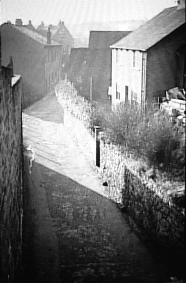
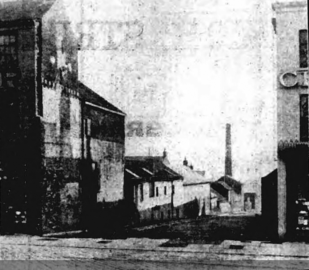
Further up from the last photo, Wheeldon Lane looking up towards the entrance opposite the Market Hall.
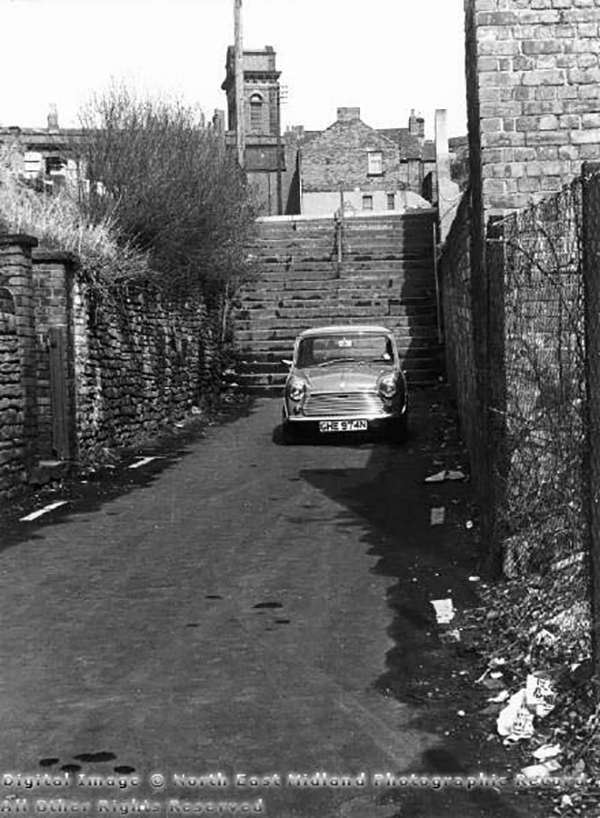
The steps that were created when New Beetwell Street was built. This picture is looking towards the Market Hall from the entrance to Wheeldon Lane just past the Ragged School on the right. Probably taken in the 1960s.
The view south from the steps. Ragged School on the left and Queens Park Hotel beyond.
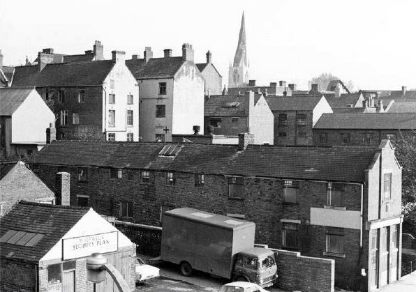
Beetwell Street in the 60’s – Wheeldon Lane to the right of the large building in the centre of photo.
As above.
This where Wheeldon Lane emerged onto Low Pavement.
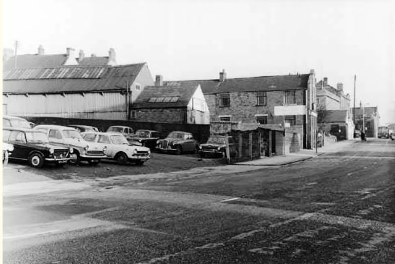
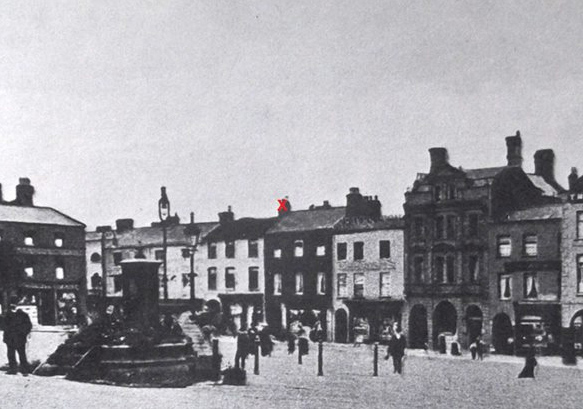
The Three Tuns was situated on Low Pavement, above is a photo of Three Tuns yard in 1911. This site is now the pedestrian walkway from the market to the Library and the Pavements Shopping Precinct and, prior to that, Tontine Road.
Three Tuns Inn (via Jane Kirk – red X marks the spot)
The Three Tuns was demolished in 1914 to make way for the construction of Tontine Road.
Of the three photos shown below the first two show the state of the yard before demolition, the third shows the pub gone and the view from the Market Place down Tontine Road, with Greaves chemists on the right hand side
The creation of Tontine Road also required the demolition of Daniels Yard.
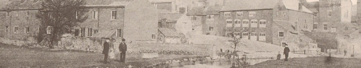
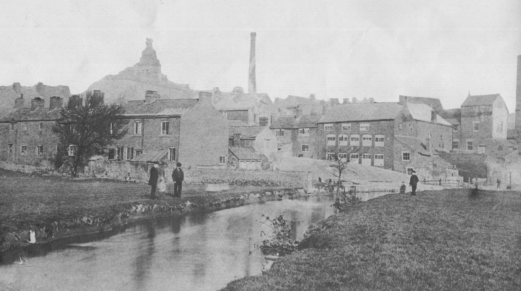
One of the first photographs of Chesterfield taken in the 1870’s or earlier, showing the river Hipper flowing through Maynard’s Meadows past the bottom of the yards of the Dog Kennels area. Evidence of some of the past and forgotten industries is shown.
In the centre is the chimney of Mason’s tobacco cutting factory on Wheeldon Lane.
The factory building on the edge of the river was Holland’s lace mill at the bottom of Froggatts Yard. The mill closed in 1848 but was reopened for lace making by Francis Hurst & Co until that too failed and the building became a lodging house.
The building on the far right (left of chimney) at the bottom of Wheeldon Lane is thought to have been the old Wheldon Hall which was rebuilt as Waterhouse’s Lace Mill.
On the left of the photograph is a row of houses at the bottom of White Horse Inn Yard. The houses in this yard are said to have been occupied by the makers of beaver hats, once a flourishing trade in the town.
In the background, clearly visible is the Market Hall.
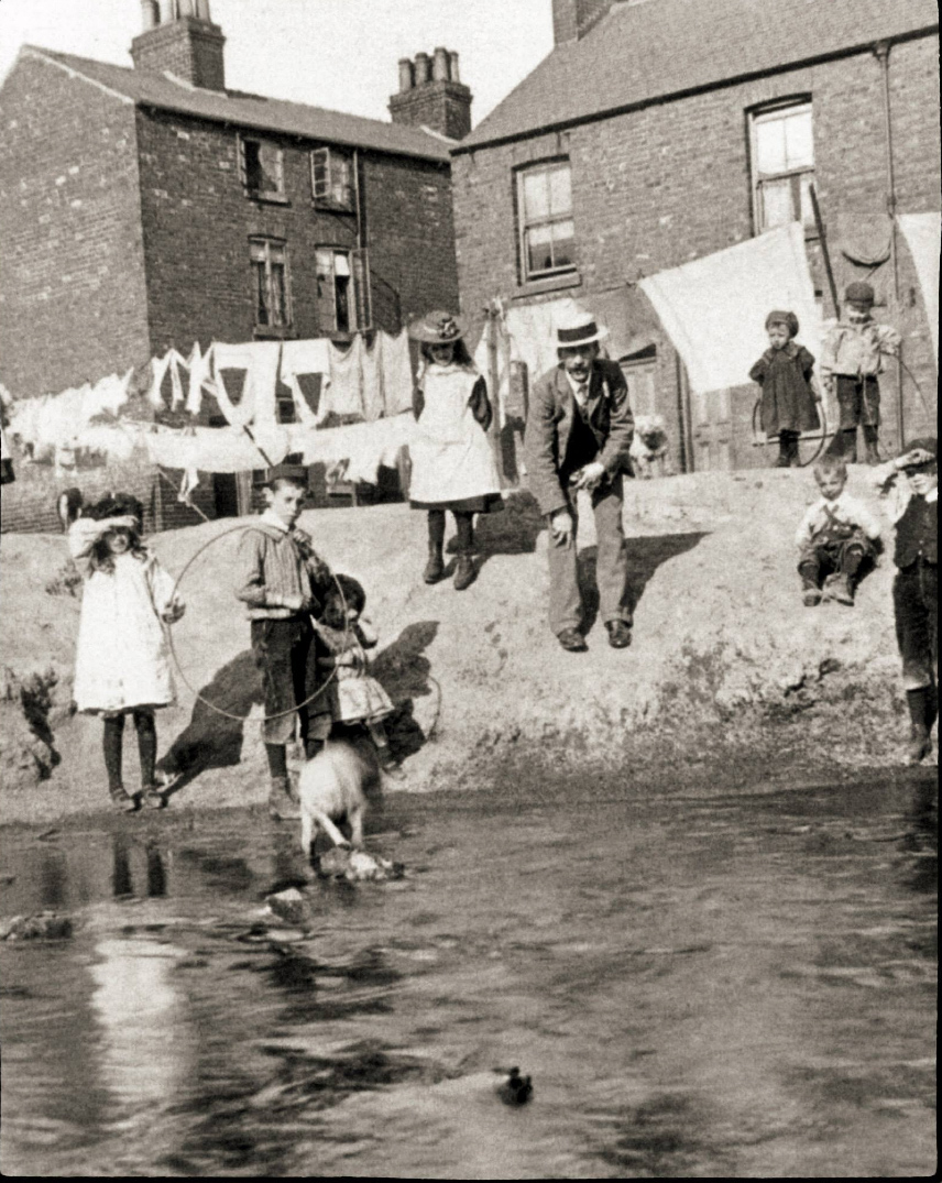
Children playing on the banks of the River Hipper in 1901. The position of this photo is marked on the map as number 9.
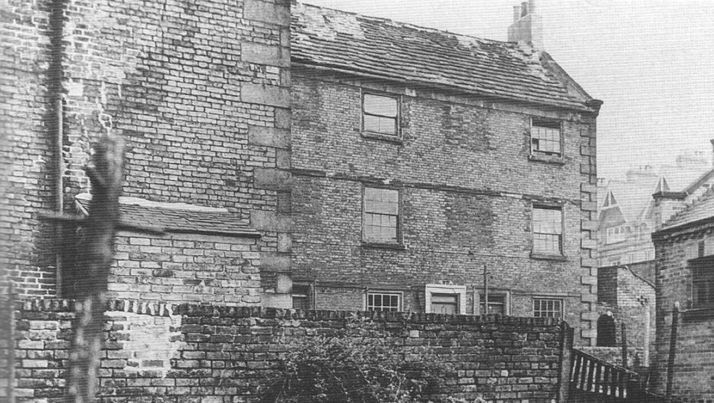
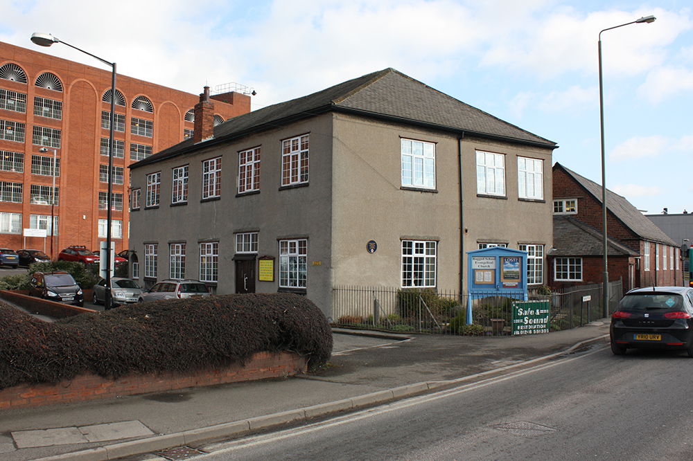
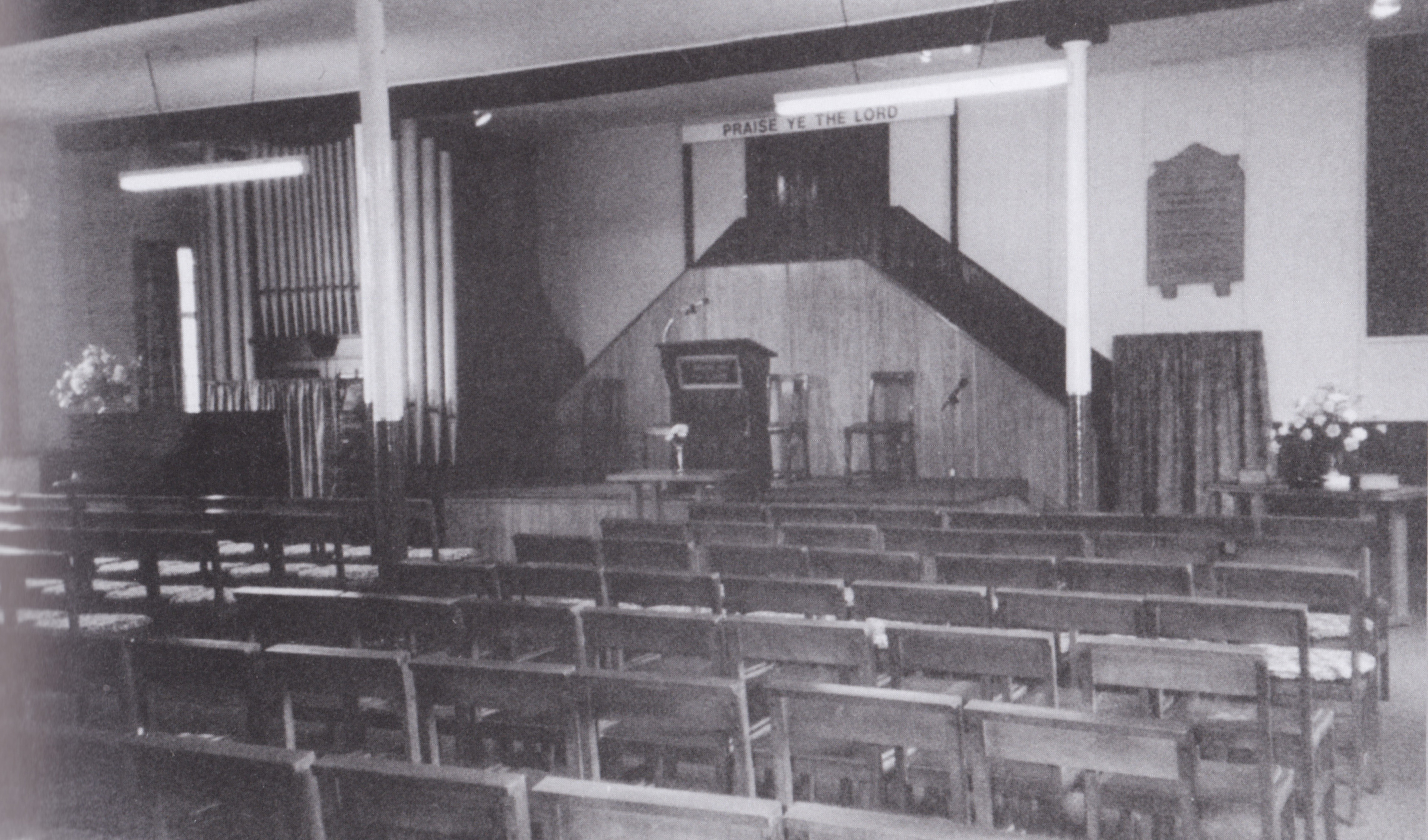
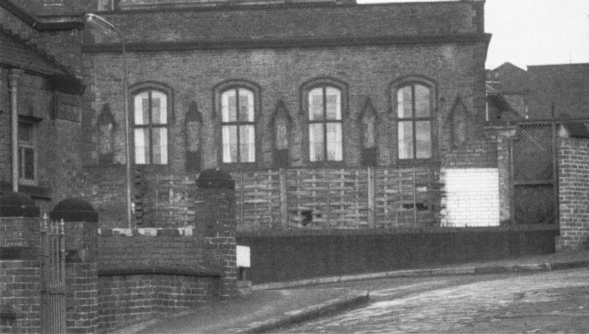
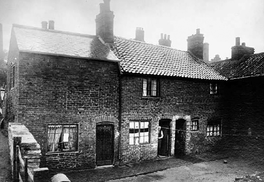
The Ragged School is one of the oldest buildings in the Dog Kennel area. It is important as one of the few surviving buildings from the Dog Kennels area and the remains of Wheeldon Lane, the western boundary of the Dog Kennels can be seen running down the side of the Ragged School – this road ran up to Low Pavement opposite the Market Hall.
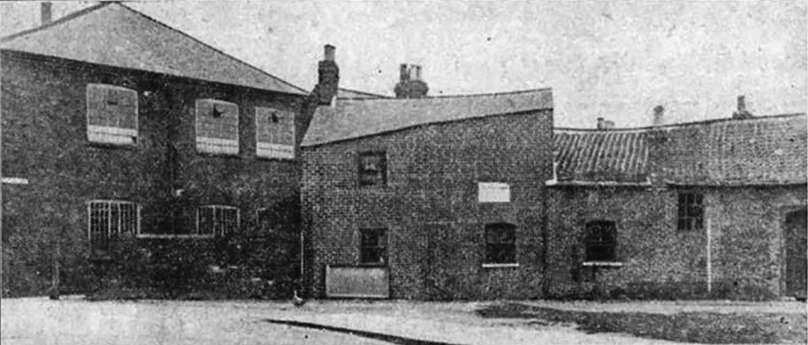
Ragged School in 1911, the year before the Dog Kennels was demolished. The school building is on the left, the buildings centre and right were demolished in 1912 when Markham Road was built.
Originally a factory, the development of the Ragged School is detailed by David Botham, below.
Some background on the Ragged School from David Botham.
“Yes, but why is it called the Ragged School ?” they ask.
To understand this one needs to know a little about the industrial towns of Victorian England. Factories grew unplanned and uncontrolled wherever the enterprising industrialist could find essentials such as a source of water power or reasonable communications. Such places attracted a labour force of poor folk, sometimes displaced from their place of birth by the harsh realities of 19th Century life. Without work you starved. During the Irish potato famine people starved anyway, some migrant workers came to the industrial towns to find a living. Often it was a hard living since they rarely got help in finding food or shelter. Model villages like Bournville or Saltaire were the exception . Most new arrivals had to begin by renting lodgings in the roughest part of town. Some never got beyond that, even if they acquired a family. Their offspring ran about the alleyways, barefooted scavengers in ragged clothes, uneducated and often uncared for. Desperate for food, they would take menial jobs for long hours in appalling conditions from as young as ten or eleven years old.
In the mid-nineteenth century, Lord Shaftsbury was a key figure in drawing attention to the plight of such children. He encouraged the establishment of free Sunday schools in the poorest quarters of large towns and cities to teach the scriptures and impart some elementary Christian education. These were run by volunteers and often took on a wider role, acting as a welfare centre too.
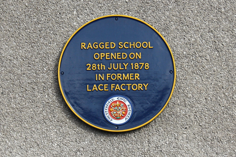
At one time there were over a hundred such schools in England. In 1878 one of the last to be established was opened in Chesterfield. They were called Ragged Schools simply because they were for ragged children.
At this point the more persistent enquirers usually pose a couple of further questions.
” Well it doesn’t look much like a church and anyway, why build it there where there are no houses ? “
The first observation is accurate. The main building was never intended to look like a church for the simple reason that it began life as a factory. The chapel records indicate several different owners, using the premises for a variety of purposes which will be described later.
As for the houses, I am reminded of the question asked by a visitor to Hardwick Hall.
” It’s a wonderful place but why did Bess build it so close to the motorway?”
When the Ragged School opened there was no traffic thundering by. There was no Markham Road, New Beetwell Street, bus stand or car park. The townscape consisted of a rabbit warren of narrow alleyways running south from the market place right down to the banks of the river Hipper. In 1878 these long yards were tightly packed with all kinds of industry interspersed with rows of terraced workers cottages.
The reason for this pattern of development is a fascinating story which is well worth a brief digression before we return to the school itself. Chesterfield stands on a crossroad. Trade routes linking Chester and the west coast with Lincoln and the east meet the Rother valley running north followed by the old road from Derby to Sheffield and Leeds. This junction has been of significance since Roman times and sustained a market town long before its first Royal charter, granted by King John in 1203. On the south side of the market place ancient medieval burgage plots of unusual length set a pattern of land ownership that survived right into the twentieth century.
An indication of the plot widths can still be seen in the Low Pavement frontages with their mixture of former houses, shops and coaching inns. Archways gave access to outbuildings and smallholdings at the rear.
On Glossop’s map of 1827, these are still mostly indicated as gardens and orchards. Stables, workshops and small cottages cluster around alleyways from the Market Place. Some factories are already evident along the river. By 1837, a square block has been added at the end of Wheeldon Lane, which matches the size and location of the present main two storey building. According to the deeds, this was used as a carpet factory, tobacco and pipe factory and warehousing. It may also have been a lace mill. Just before the mission opened, it was in use as the Waggon beerhouse with common lodgings on the first floor.
By the 1870s, many of the long yards had been developed to provide cheap terraced housing alongside a variety of mills, foundries and other commercial enterprises. The area began to acquire a doubtful reputation. Before long, policemen were instructed not to venture alone into the alleys. A resourceful superintendent once swore in a large group of roughs from the area as special constables and kept them cooped up in the market hall all day in expectation of a riot only they could have started! Life certainly dealt you a mean hand if you had the misfortune to be born in such a place.
Four young men in the Sunday School Union were deeply moved by the plight of the children and felt called to start a mission. In 1876 they began distributing tracts. Cottage meetings were held for a while but had to be abandoned because of an outbreak of fever. Seeking premises to establish a permanent work, they found the former factory on Wheeldon Lane vacant. Its previous tenants had run such a bawdy beer and lodginghouse that the authorities had closed it down. The position was easily reached on foot. From the market an archway (by Joplins) led to Wheeldon Lane. Although no wider than a cart track, this led to a ford across the river and was a busy thoroughfare. From east to west there were no roads of any kind but a narrow ‘ginnel’ linking the long yards emerged from a gloomy passage under the old factory at this point. Traces of the archway and bracket for the gas mantle can still be seen. The name of the ginnel was also the name of the area. Dog Kennels was the name on the blue enamelled sign that still rusted on the wall sixty years after the alley closed. The mission team duly rented the upper room and opened for the first time on Sunday, 28th July, 1878. One hundred and nine children came that morning. The four teachers enlisted more help. After two weeks, an afternoon meeting was added. After three weeks, an evening gospel service was held, attended by fifty adults.
The mission continued to grow. A teachers meeting was inaugurated to govern the school. Minutes of the first meeting are dated 30th October, 1878. On May 5th, 1879, the Ragged School became a member of the Chesterfield Sunday School Union.
Public support for the work, especially from other churches, was generous. Denominational differences were put aside as donations of books, food and other gifts were sent. The founders seem to have resolved from the very first that they would devote all available resources to the local work and waste nothing on formal ties with Methodist, Baptist, Congregational or other organisations but rather welcome them all as friends and fellow workers. This remains true today.
The effectiveness of such wholehearted concentration on the job in hand is reflected in the attendance records. By 1885 there were 340 scholars and 27 teachers on the books. More impressive still was the proportion of these who were coming regularly. Average weekly attendances were 319 and 24 respectively.
Discipline must have been very difficult, to maintain. The school rules are most illuminating. The requirement that” Teachers shall not hesitate to move from their accustomed places to quell a disturbance..” (rule 7) rather suggests that quelling was frequently needed!
Mid-week meetings and social events were soon added to the school’s calendar. Band of Hope, Sisterhood, Christian Endeavour, classes of various kinds, Christmas treats, summer trips and games, special mission weeks all gave interest, direction and purpose to the lives of those involved. When it became evident that many of the children were poorly fed and rarely had anything for breakfast, the teachers organised a basic meal before Sunday school. It is not known how many years they were able to continue this kind of help, but it certainly made the place even more popular! The Ragged School Chesterfield by DF Botham
Chesterfield’s Municipal Hall was built in 1847 on the site of the old Guild Hall. It was built 12 years after the passing of the Municipal Reform Act of 1835 and was used as a Council Chamber and Police Court. The building closed in 1965 and is now demolished.
Map: C2
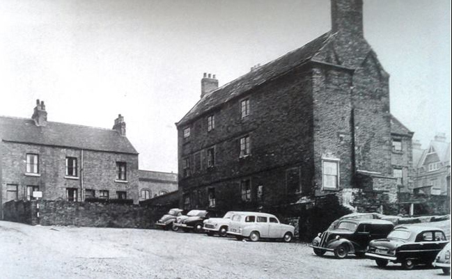
This picture of the Municipal Hall, which was being used as a courthouse, was taken looking north from South Place – the Slipper Baths can be seen on the left
Map: C2
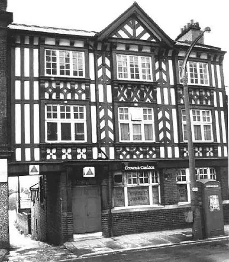
Looking west from Beetwell Street the Munipal Hall is directly opposite the end of the street (centre) – in the foreground on the left is the Eagle Hotel, now renamed the Spread Eagle Hotel. Some of Spread Eagle Yard, running down to the right hand side of the Hotel, is still there today – well worth a visit to this pub.
Map: C2
Above – Municipal Hall just prior to demolition in 1965.
The old Guild Hall demolished for the Municipal Hall
Below is footage of the Bowling Green in 1933 in which the Municipal Hall can be seen in the background.
Chesterfield’s Municipal Hall was built in 1847 on the site of the Old Hall. It was built 12 years after the passing of the Municipal Reform Act of 1835 and was used as a Council Chamber and Police Court. The building closed in 1965 and is now demolished. – See more at: http://jiscmediahub.ac.uk/record/display/061-oaiwwwculturegridorgukPictureThePast2249916;jsessionid=1EED77F18AE387BCD53E691AA67FB4E9?mhevent=related?mhevent=related#sthash.2TlyfVPN.dpuf
Chesterfield’s Municipal Hall was built in 1847 on the site of the Old Hall. It was built 12 years after the passing of the Municipal Reform Act of 1835 and was used as a Council Chamber and Police Court. The building closed in 1965 and is now demolished. – See more at: http://jiscmediahub.ac.uk/record/display/061-oaiwwwculturegridorgukPictureThePast2249916;jsessionid=1EED77F18AE387BCD53E691AA67FB4E9?mhevent=related?mhevent=related#sthash.2TlyfVPN.dpuf
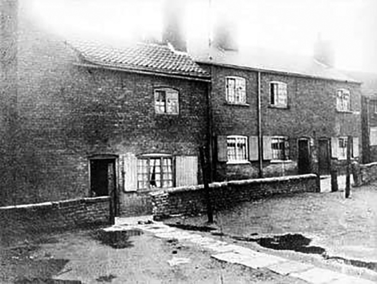
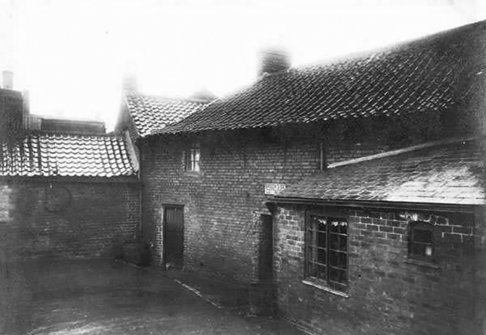
In the southern area of the Dog Kennels, Bradshaw Place was near the Hipper and the Ragged School. This photo shows the northern end of Bradshaw Place at it’s junction with Dog Kennels passage.
 Eden 1797
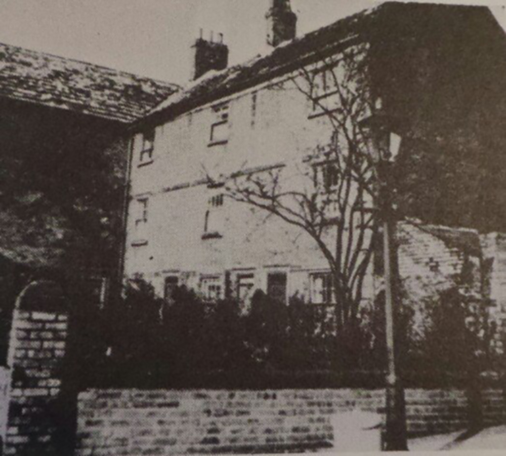

You must be logged in to post a comment.