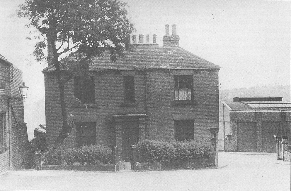
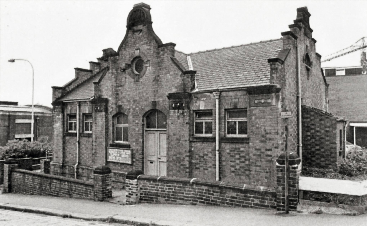
This lovely old house, which was opposite the Slipper Baths in South Place, once belonged to Thomas Dodd, a scrap metal dealer in Brampton.
Behind the house is Markham Road and to the right was the Slipper Baths.
This lovely old house, which was opposite the Slipper Baths in South Place, once belonged to Thomas Dodd, a scrap metal dealer in Brampton.
Behind the house is Markham Road and to the right was the Slipper Baths.
Although the Market Place is not, strictly speaking, part of the Dog Kennels, it survives as the northern border and is included here to help people get their bearings as they look around the featured areas of this site.
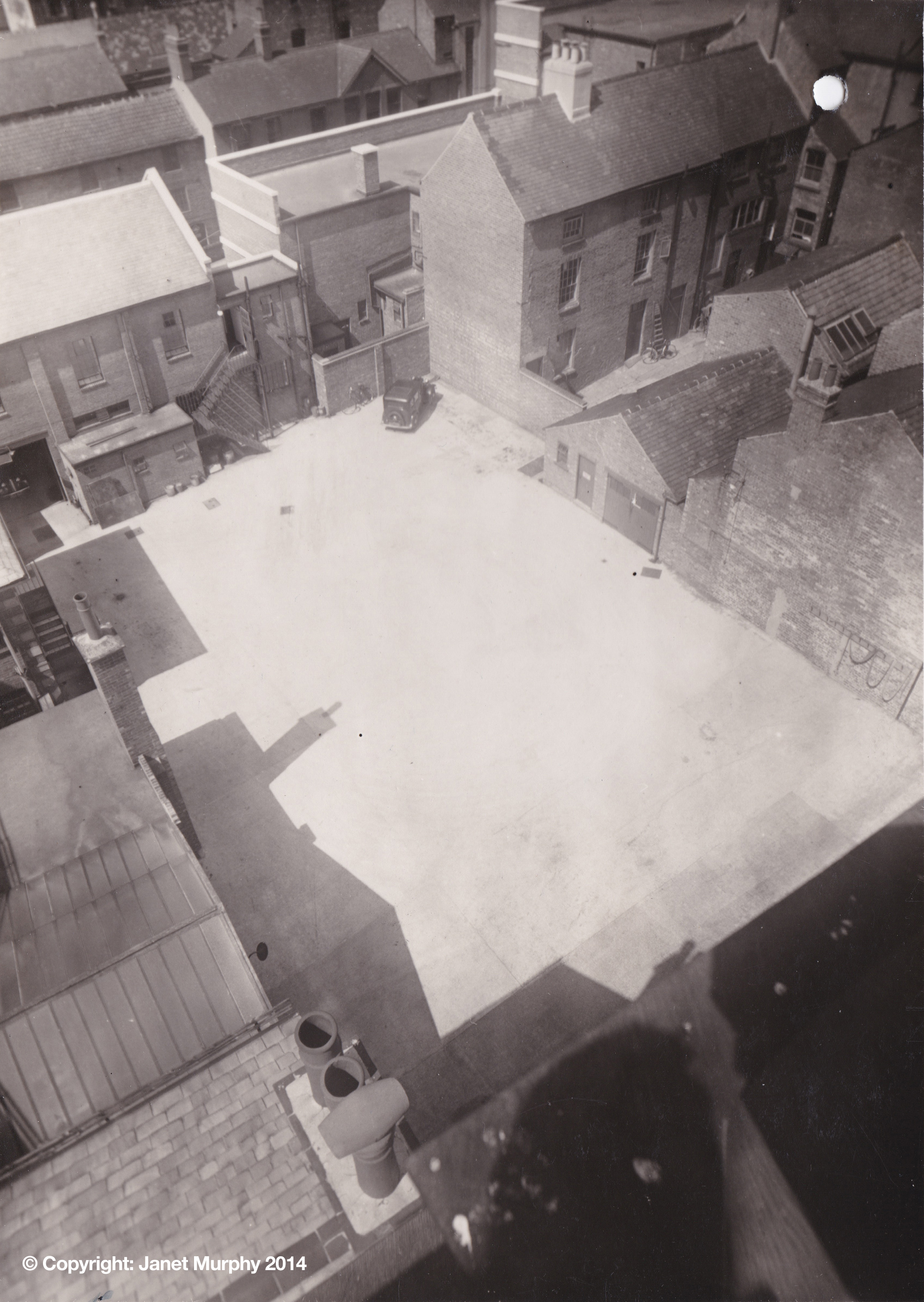
This photograph was taken after the old police station was built effectively cutting Wards Yard in two. In the centre is the police station yard and top right are three houses from the original yard that are still standing today.
Behind the houses one can see Tontine Road and the long window of Greaves the chemists. Also the roof of what is now McDonald’s.
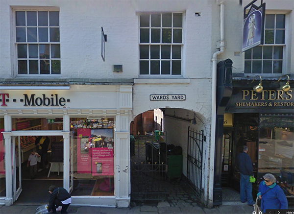
Above is the surviving entrance to Wards Yard.
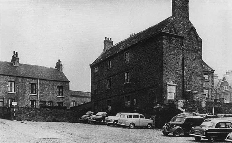
Bottom of Wards Yard in the 1950s showing the Workhouse Masters House and a glimpse of the Municipal Hall in the centre.
Where were Brookside Cottages? We know they were off Three Tuns Yard, but nothing more specific.
Can you help?
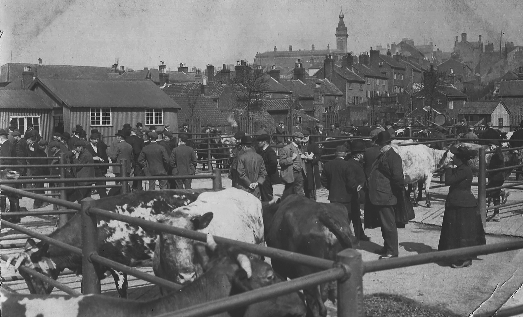
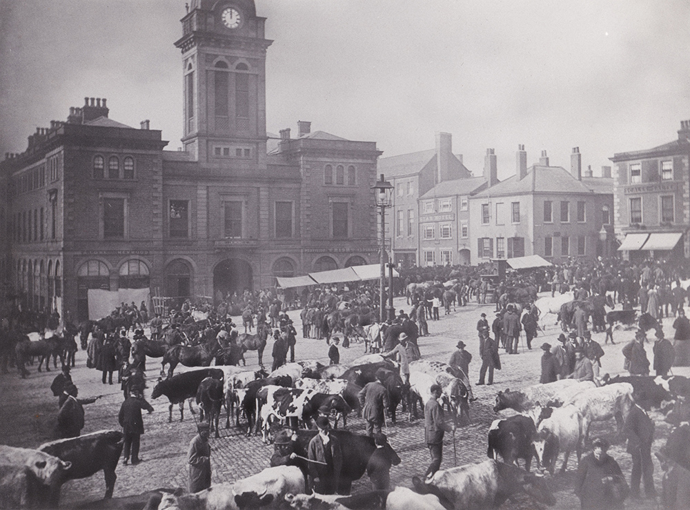
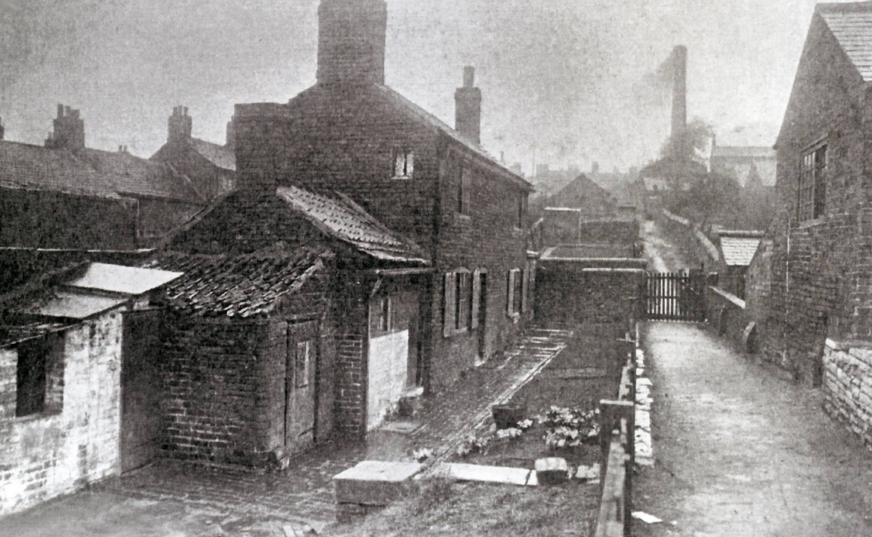
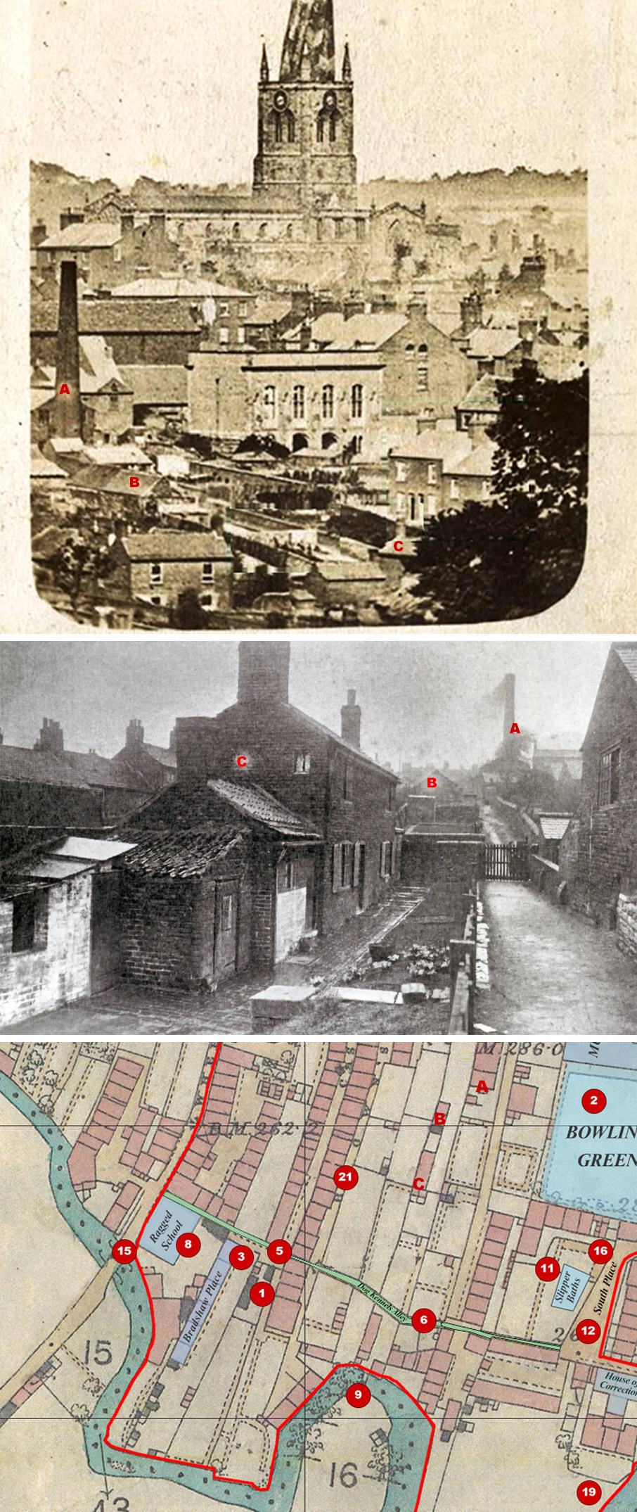
Possibly the finest, surviving photograph of the Dog Kennels, shot from the Cattle Market, looking up towards the Market Hall. Taken sometime between 1900 when the Cattle Market was built and 1912 when the Dog Kennels were demolished and Markham Road constructed.
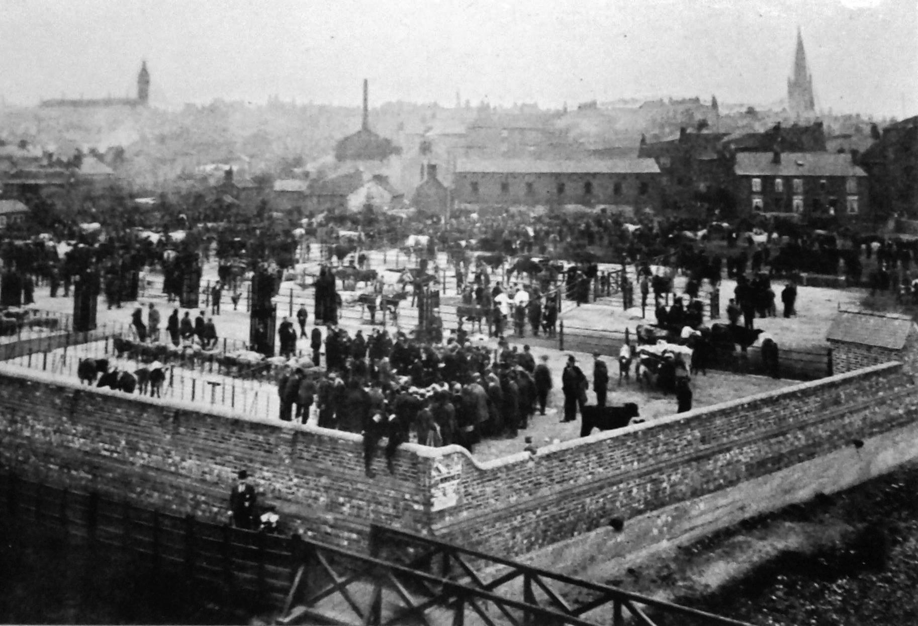
Although the cattle market does not easily fit into the main map for this site, this is an incredible photo and clearly shows its position in relation to the Hipper (immediate foreground) and its position via the Market Hall and the Crooked Spire.
The bottom end of the area between the cattle market and the Market Hall is the Dog Kennels.
After 85 years, the remains of the Cattle Market itself was demolished in 1997 to enable the building of the Ravenside Retail Park.
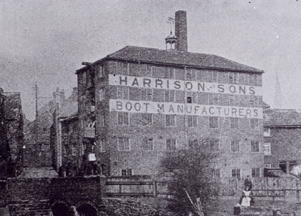
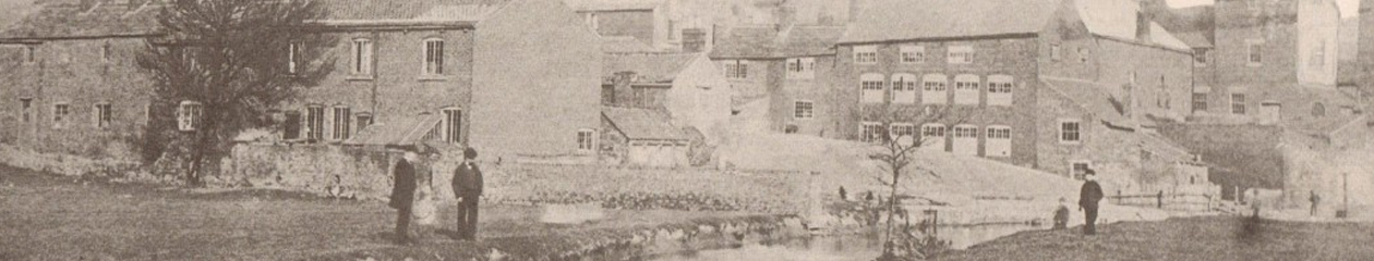
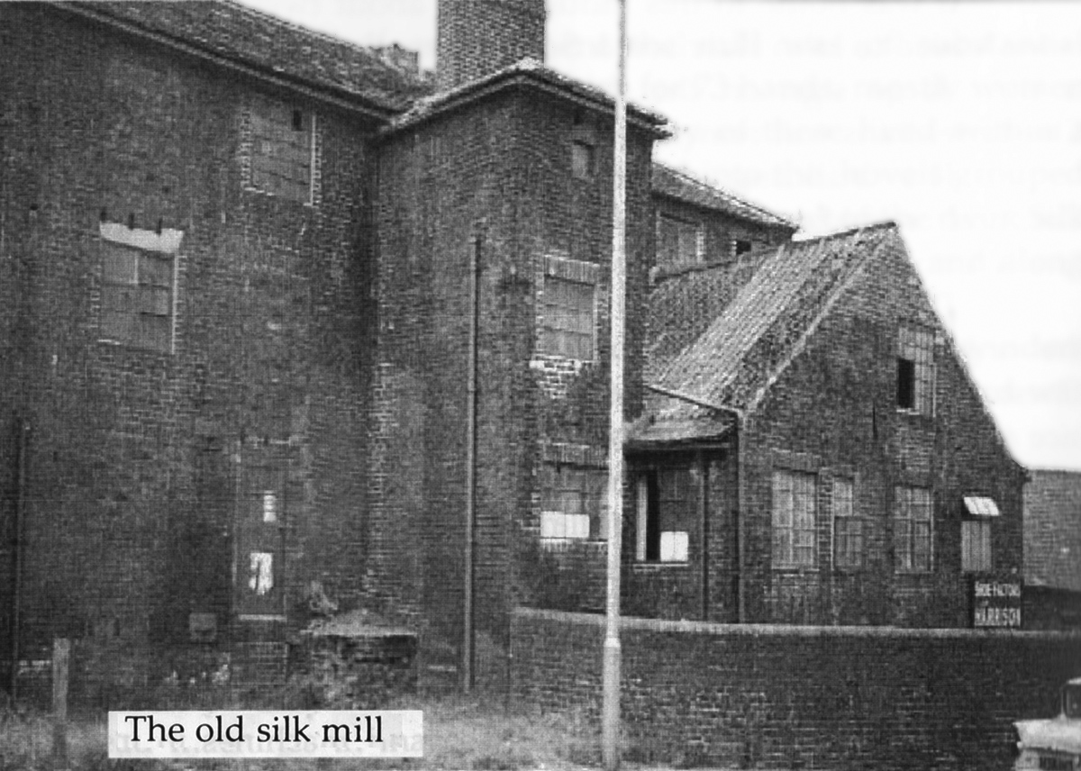
The former Chesterfield Silk Mill, erected about 1760 on the River Hipper, was leased to John Harrison and sons, boot and shoe manufacturers, in 1910. It also shows as being Beetwell Works on a 1914 OS map.
The photograph was taken between 1910 and 1915, when the river was diverted away from the mill and the Silk Mill house adjoining was demolished.
The old House of Correction, or prison, can just be seen to the left of the Silk Mill entrance.
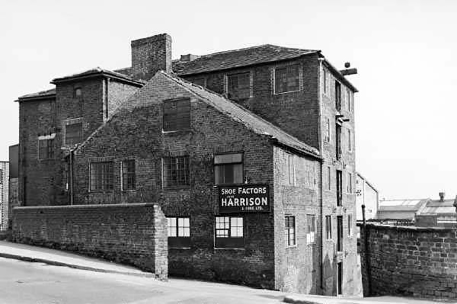
The Silk Mill/Harrisons as seen from Markham Road.
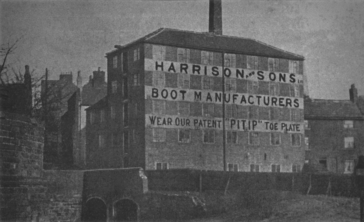
 The Silk Mill/Harrisons, seen from Hipper Street South.
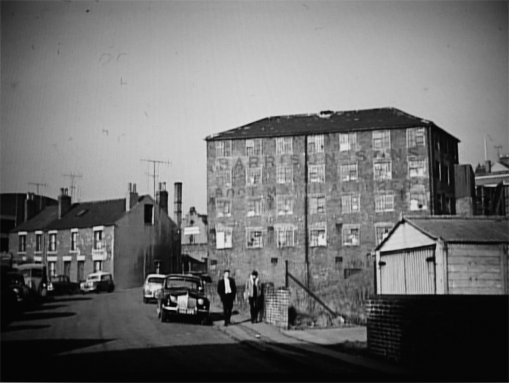
 Final days of the Silk Mill in the 1960s.
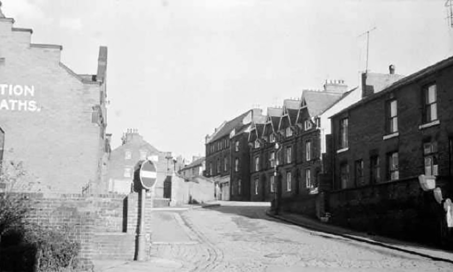
The Slipper Baths looking up South Place. At the top of the road is the Yeoman’s building and to the right of that are four houses with prominent gables – these houses crop up (and help to identify positions) on other photos.
They were built on the Eastern boundary of the Dog Kennels to help alleviate the hygiene problems and unhealthy lives of people living there.
The Slipper baths were built in 1904 and demolished in 2004.
The low wall (centre) is the eastern boundary of the Bowling Green.
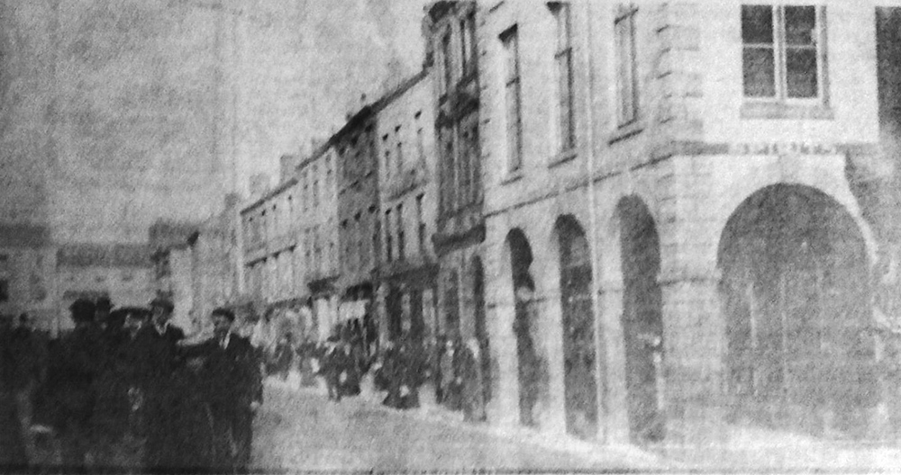
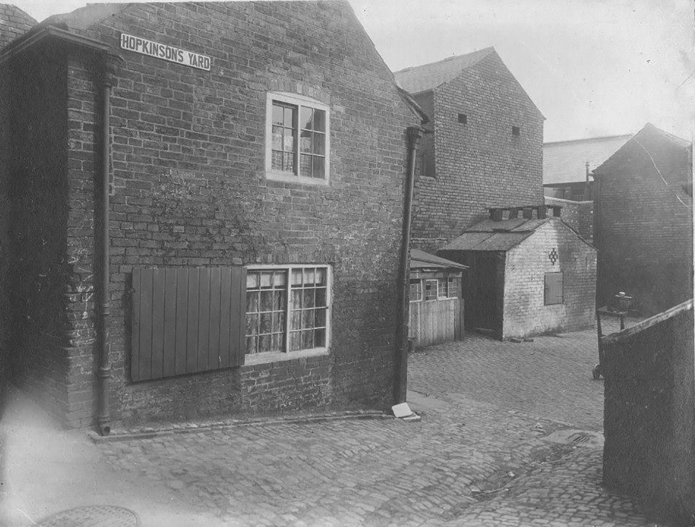
A superb photo of Hopkinson’s Yard that accurately shows the state to which these buildings were reduced by the end of the nineteenth century.
There was another Hopkinsons Yard situated off our map down towards the southern end of Lordsmill Street away from the Dog Kennels area. The photo below is listed on Picture the Past as being in the Dog Kennels, but is almost certainly the Lordsmill Street yard, now demolished.
This courtesy of Jane Kirk.
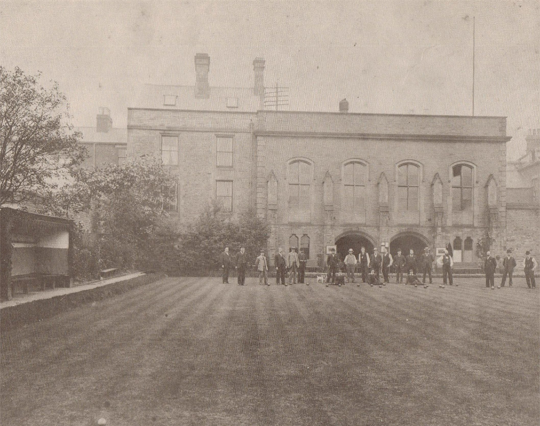
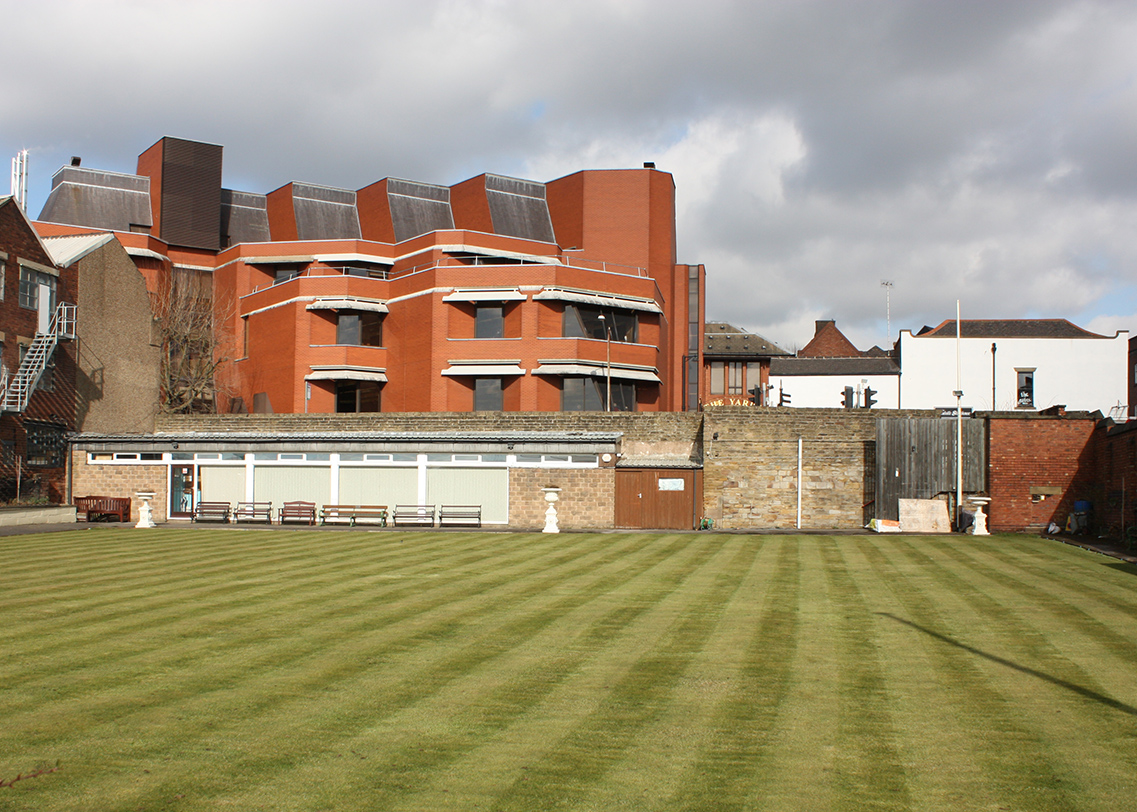
Reputed to be one of the oldest Bowling Greens in the country, Chesterfield Bowling Green is first mentioned in the 1600s although some date this back to the 1200s. It is situated on the western corner of New Beetwell Street and South Place on the opposite corner to Yeomans.
Below is footage of the Bowling Green in 1933.
Below is how the Bowling Green looks today. The Municipal Hall has gone and the clubhouse can be seen on the far side of the green. The new library now dominates the view.
You must be logged in to post a comment.